New Orleans, Louisiana
Fall 2020, Professor Margarita Jover
Future of Ports Research Studio

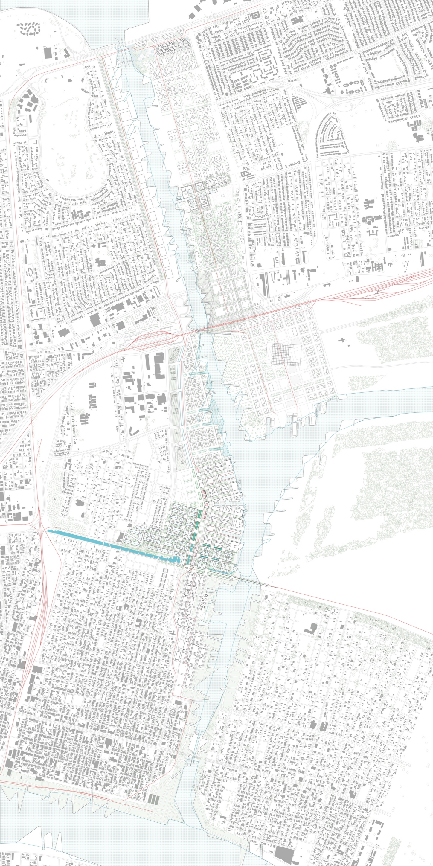
The Future of Ports Studio focused on the potential utilization of the high ground along the Inner Harbor Navigation Canal in New Orleans. The IHNC is currently owned by the Port of New Orleans and is considered private land, however, its use as an economic generator for the city has continuously declined. This studio proposes a reclamation of the land along the canal because of its underuse and higher elevations, two important factors for a city facing sea level rise and increasing inequality.
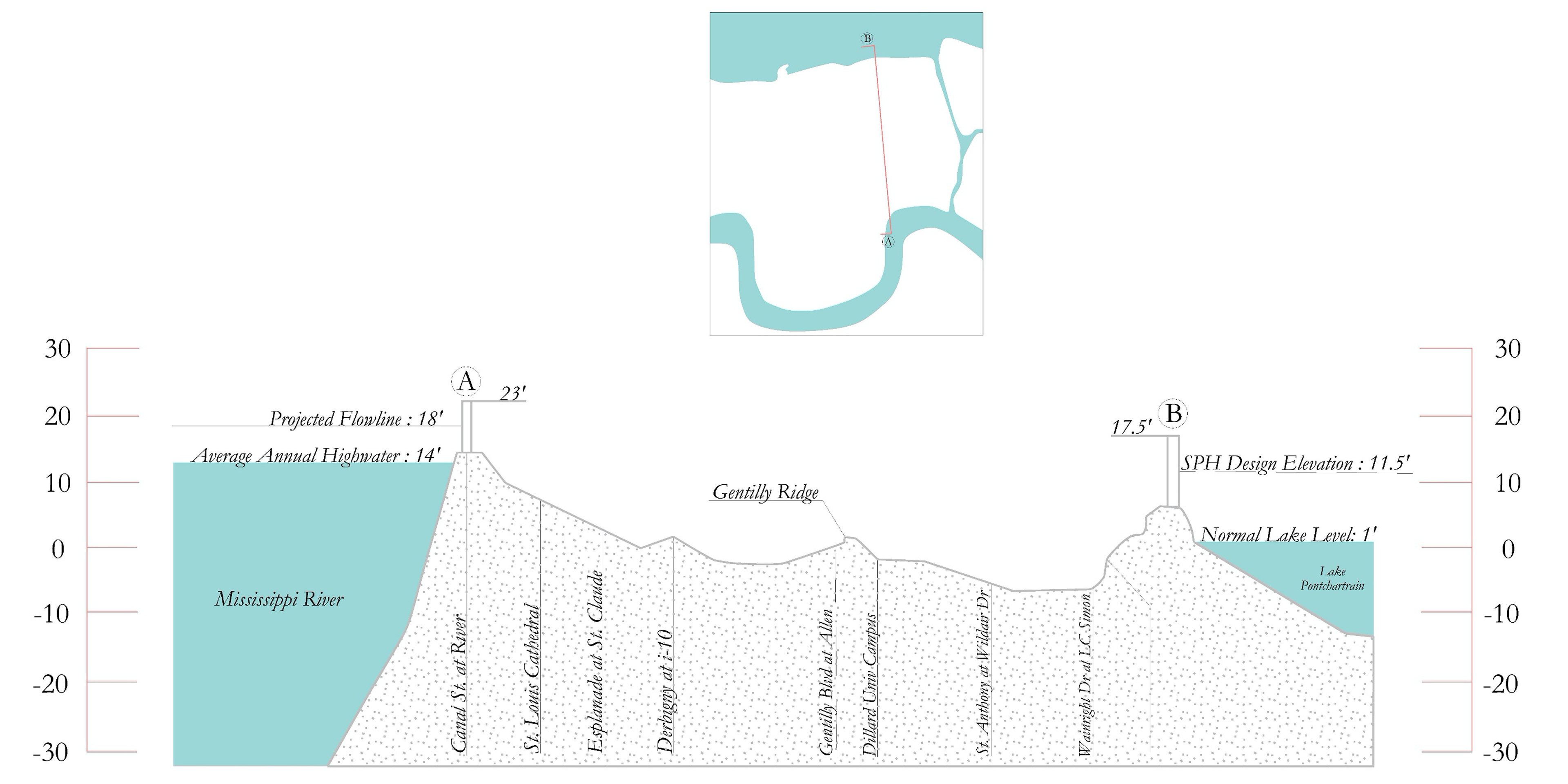
In the beginning of the semester, we were tasked with researching different infrastructural systems and the challenges they pose to the city. We focused on water. New Orleans has battled against water since its creation. The current water infrastructure is continuously pumping water out of the city, even when there is no rainfall. The system also implements thousands of miles of levees and flood walls in order to control the shorelines.
This system is failing. It is perpetuating subsidence and consistently falls short of protecting low lying neighborhoods from flooding. Due to climate change/the oil and gas industry, New Orleans is also experiencing sea level rise and loss of wetlands, which serve as hurricane buffers. The city is facing water in three dimensions.
New Orleans is located on a fluvial delta, and these threats are not unusual or unpredicted. However, in order for residents to survive continued threats from the oil industry, climate change, and sinking grounds, we must propose new ways of living. This especially includes living with water. Instead of pumping the rain out of the city and fearing its effects, what if we learned to appreciate and utilize water instead?
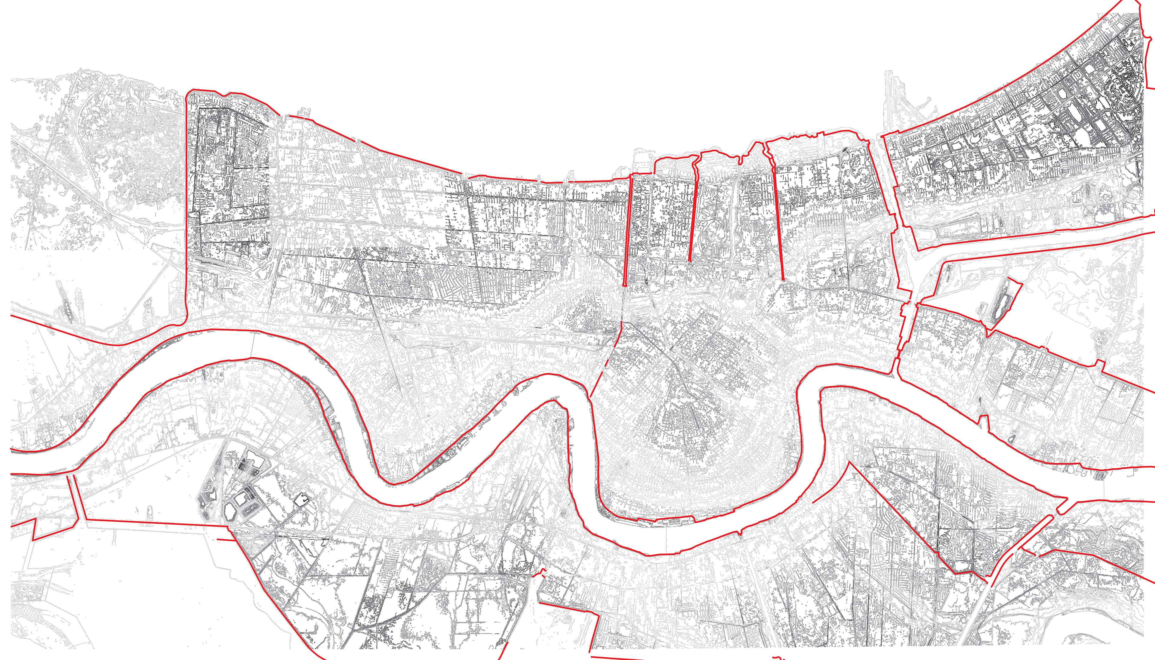
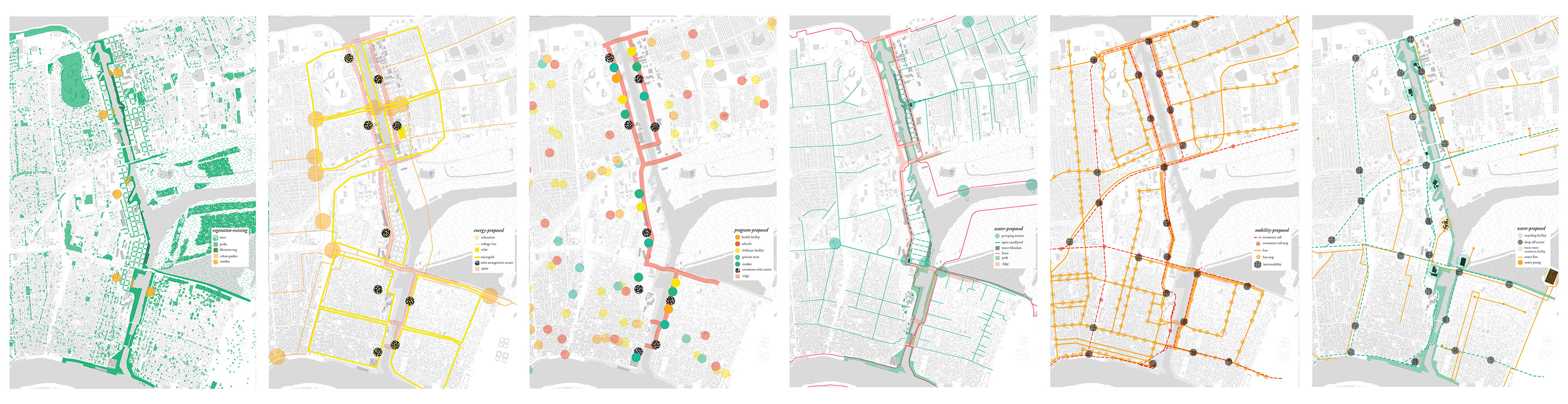
We studied New Orleans at the metropolitan scale and at the scale of the Industrial Canal. We examined current infrastructural systems, both natural and man made, and proposed alternative futures for each. Above are the proposed vegetation, energy, program, water, transportation, and waste systems.
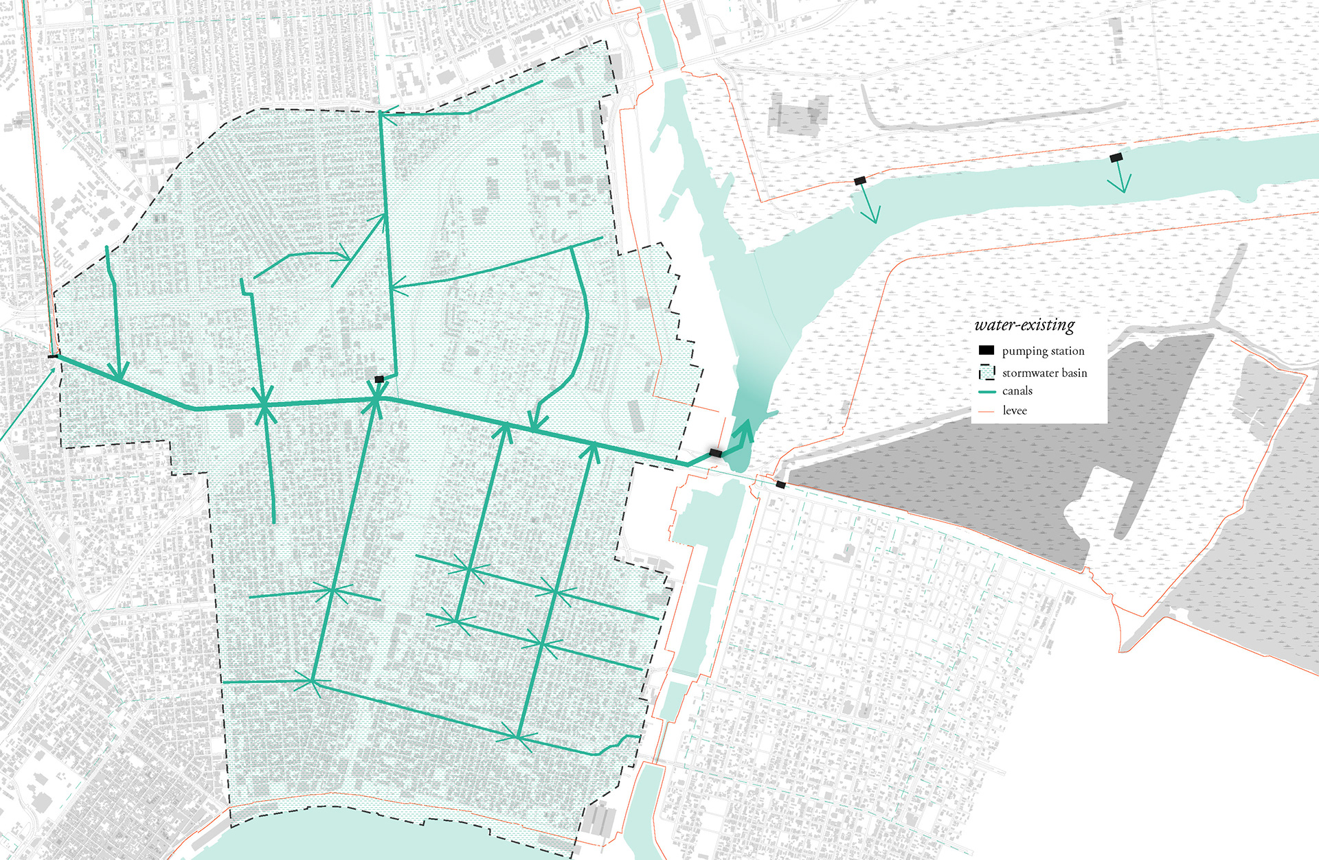
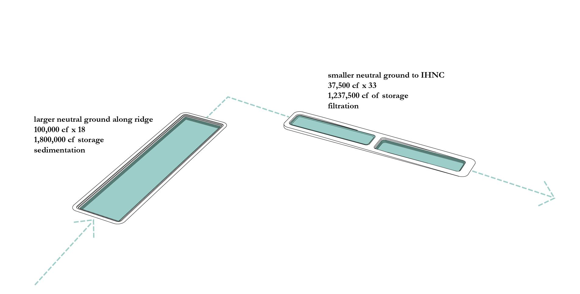
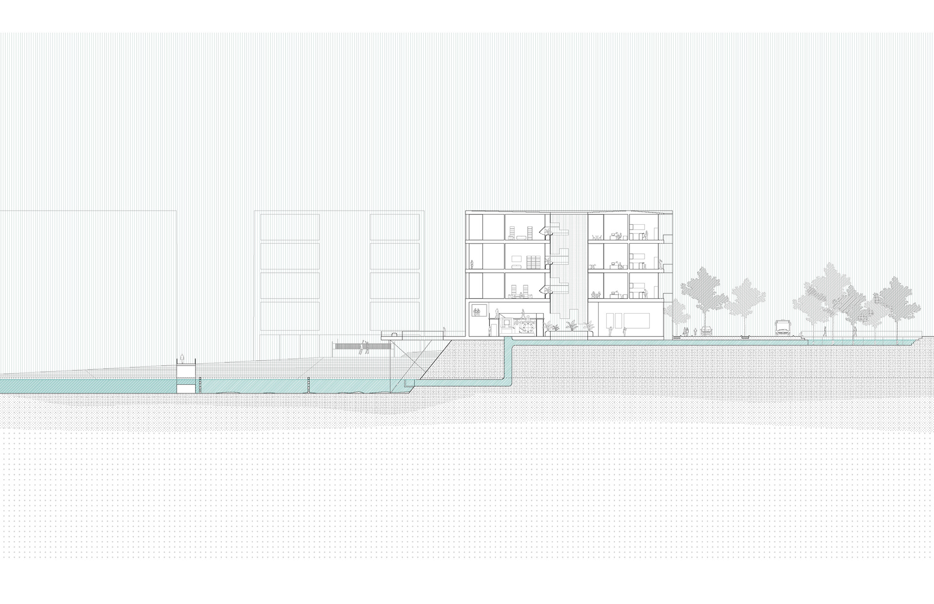
After deciding to concentrate on the water system, I studied the current pumping stations and drainage canals located along the Industrial Canal. I focused on improving the water drainage of catchment basin #19 and its pumping process. My project proposes an expanded filtration system that slowly pumps and releases rainwater into the Industrial canal. There are three elements introduced to achieve this; a filtration aqueduct, a storage canal, and three additional pumps.


In order to allow the filtration system to travel by gravity, I proposed a topographical intervention as well. The current levees and flood walls are stark dividers between protected and unprotected land. Through introducing a topographical ridge that acts as a protective element instead, the existing and proposed are gradually integrated. The ridge also allows for the filtration aqueduct to work by gravity.
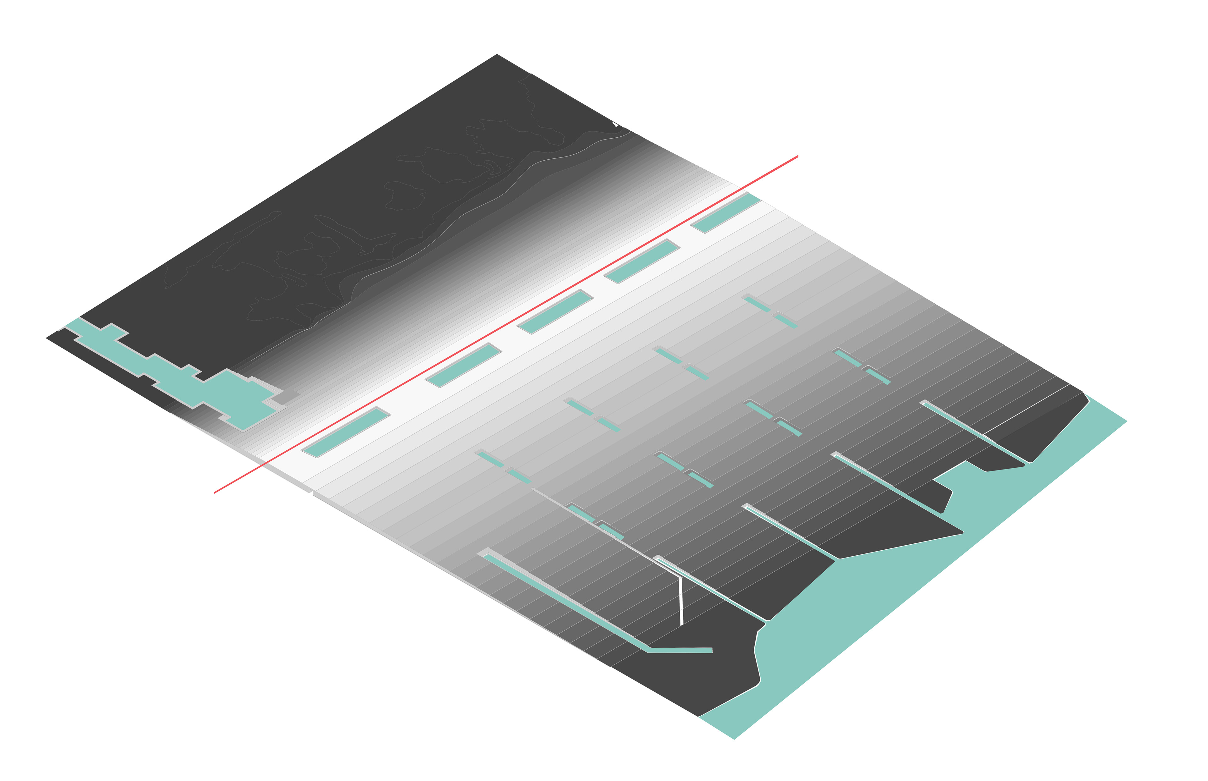

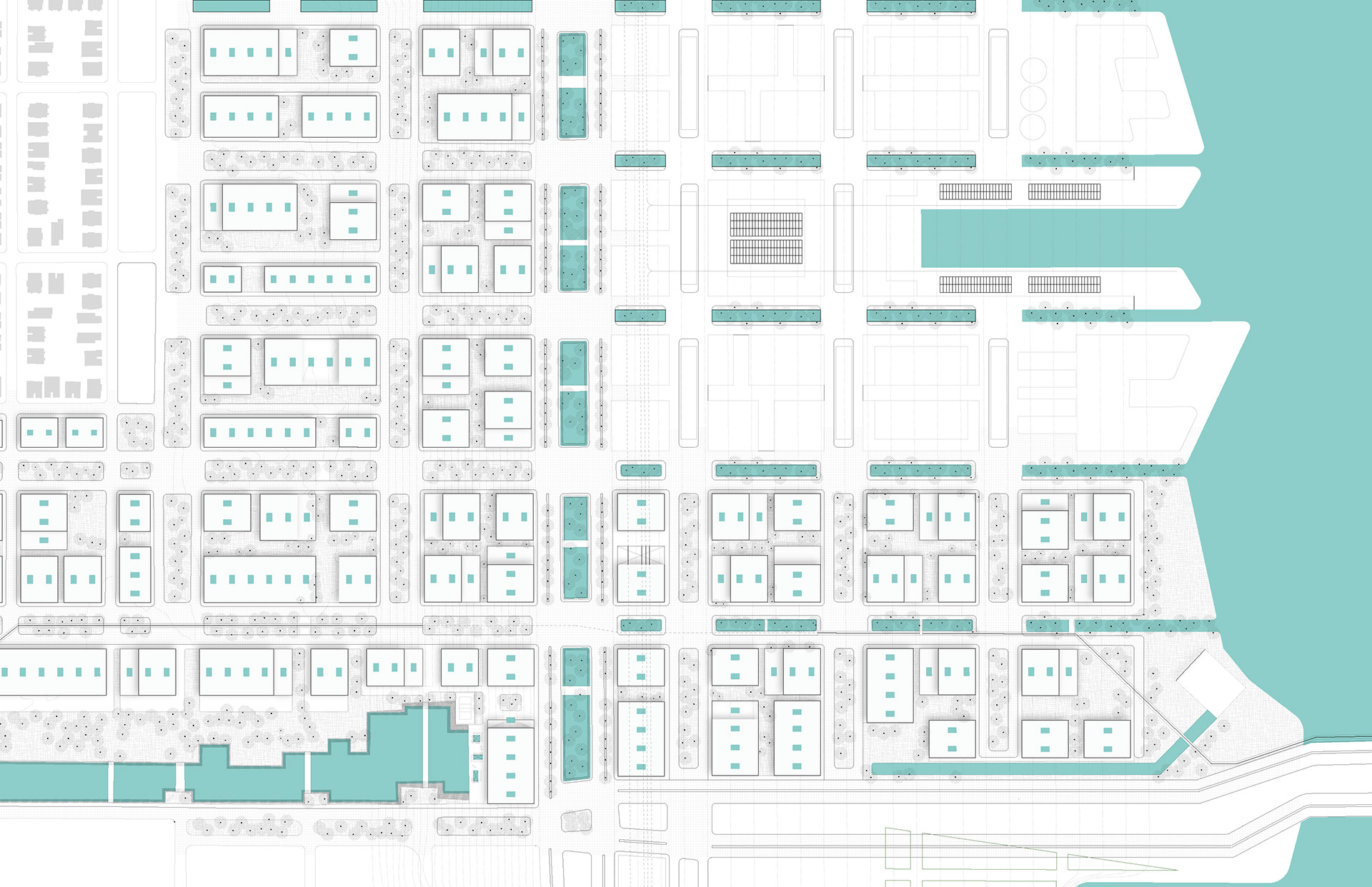
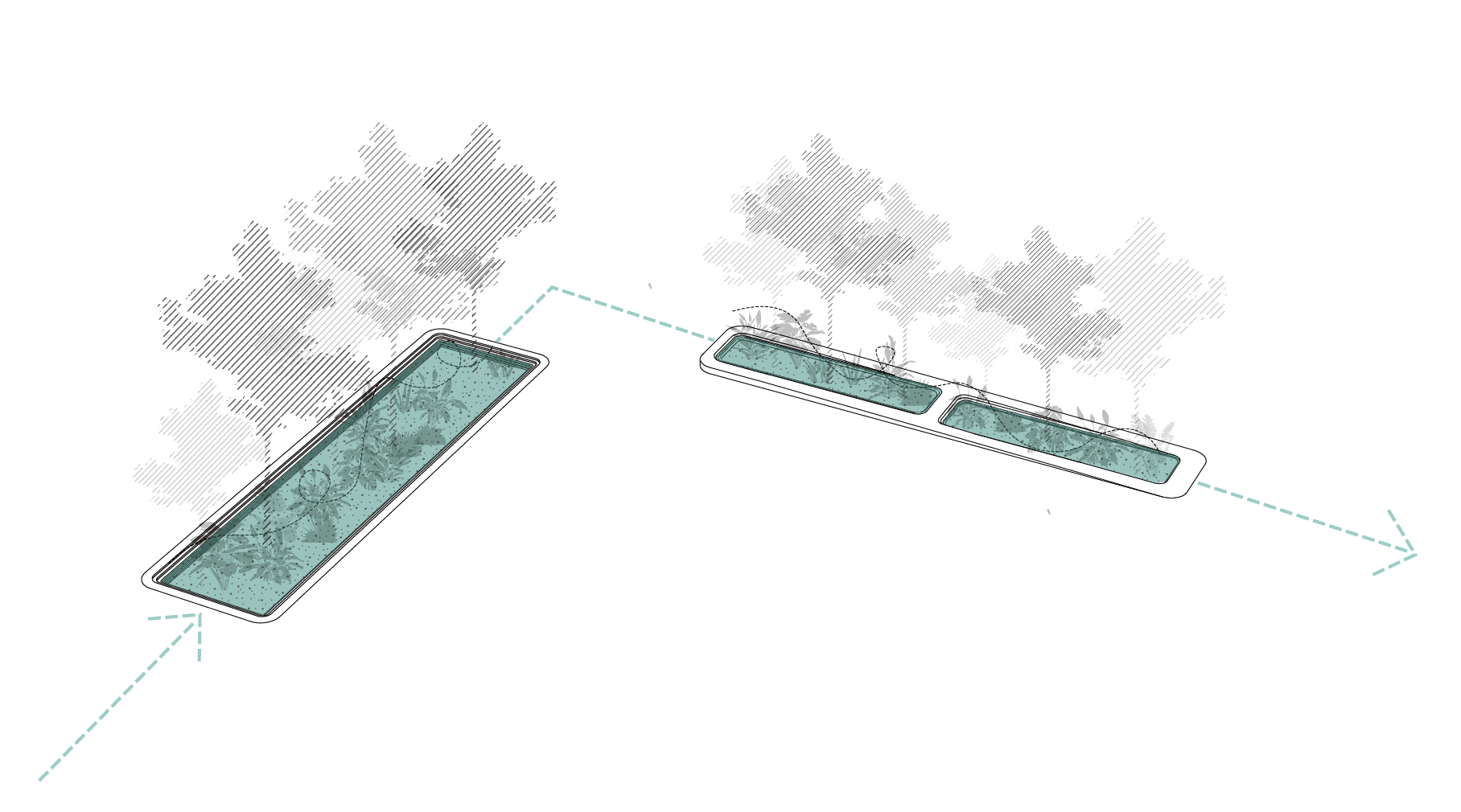

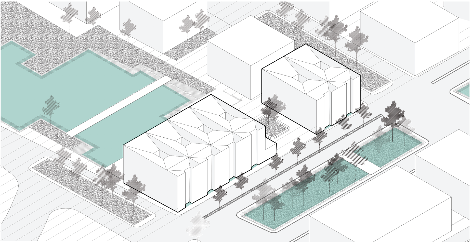
The additional pumps are housed in mixed-use buildings on the site. The buildings include an interactive museum, an auditorium, and a cafe on the ground level as well as housing units on the upper levels. The buildings within the masterplan also collect rainwater through punctuated light wells.
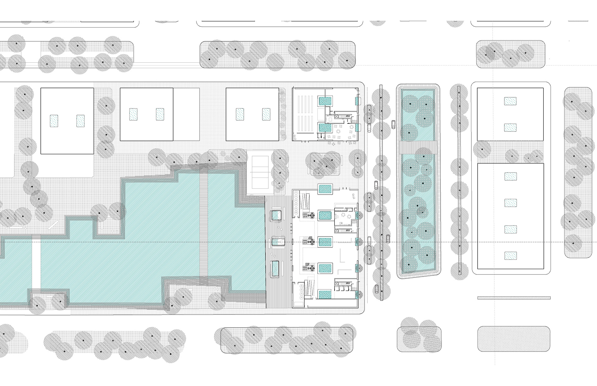

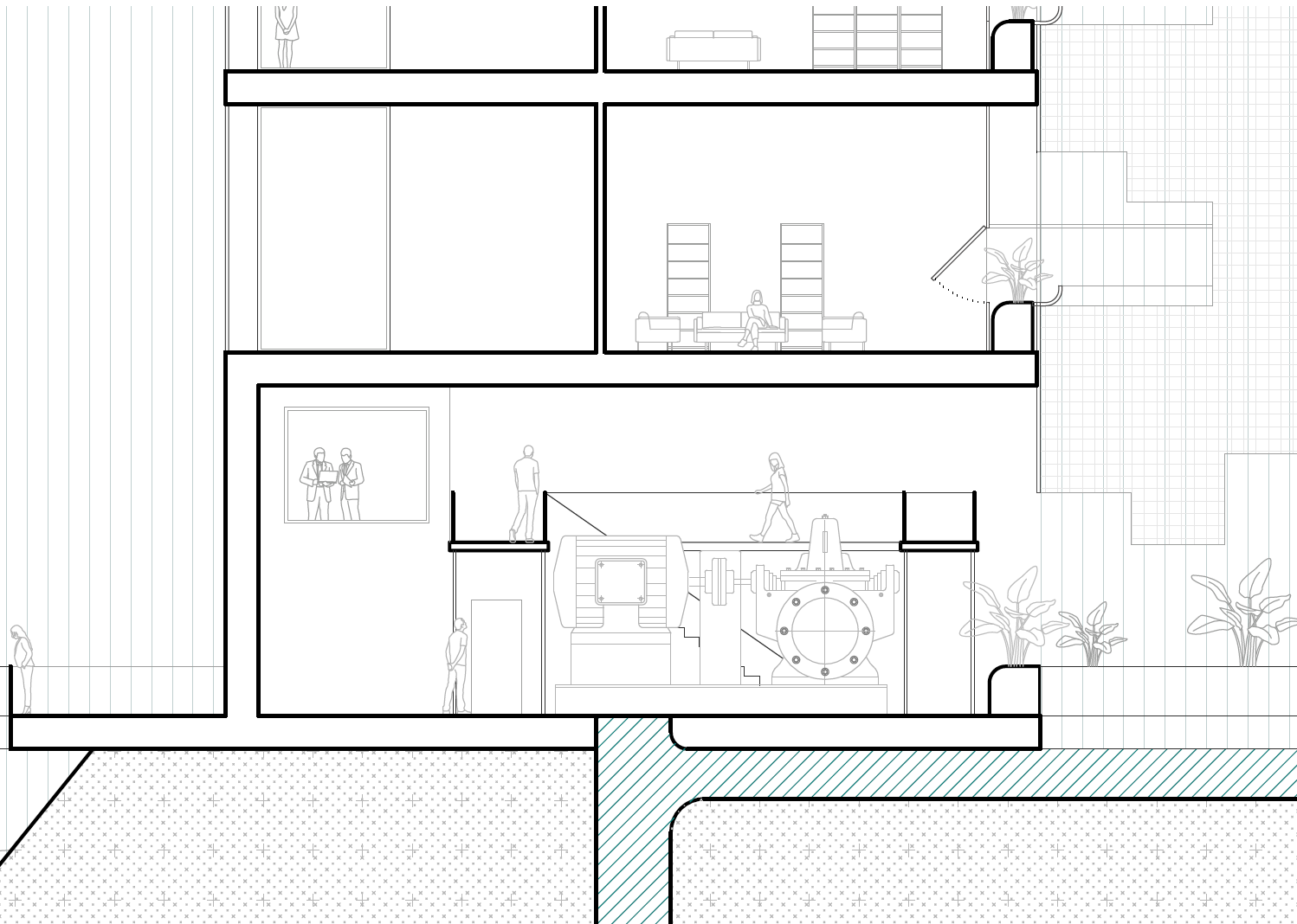
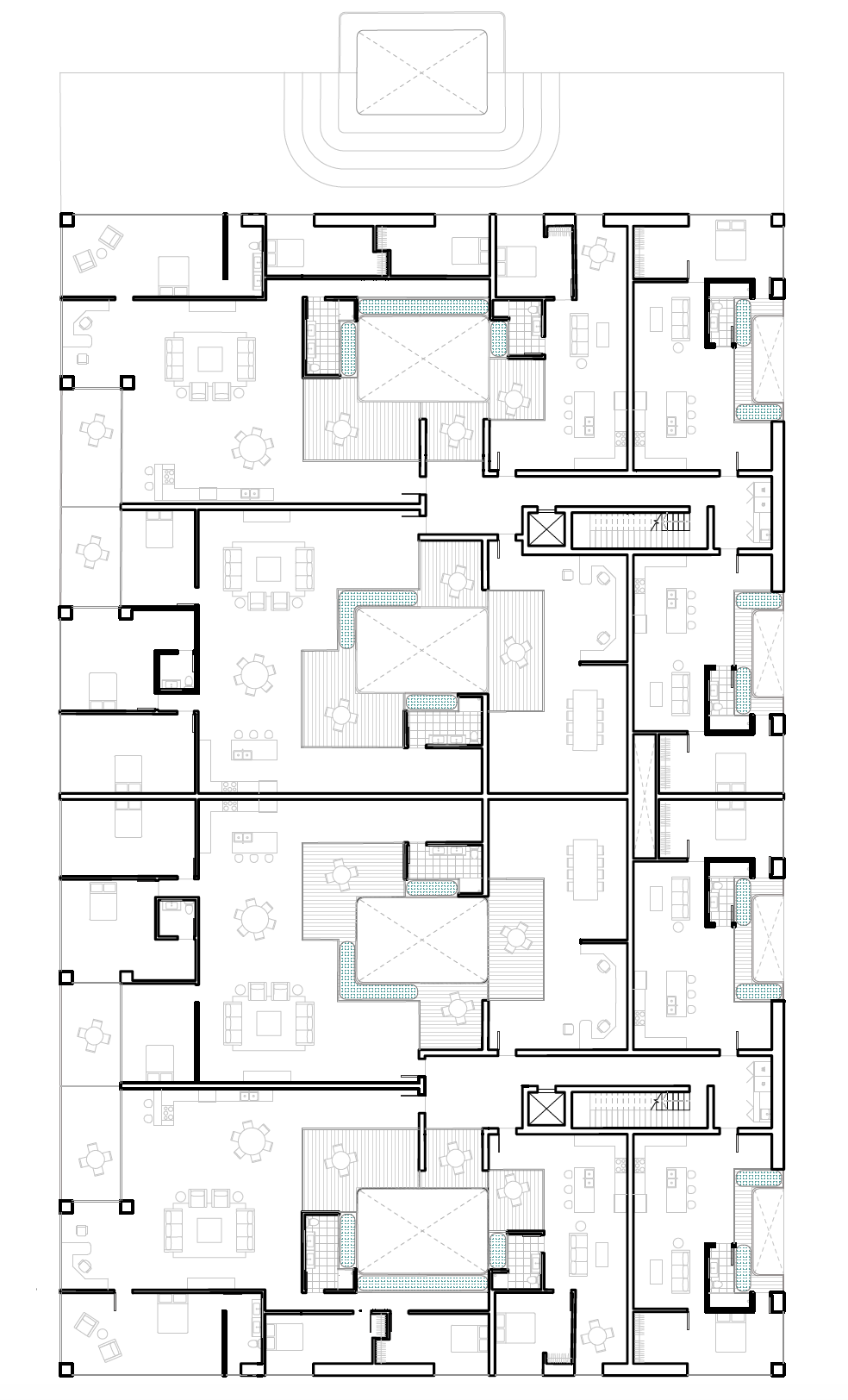
The light wells not only serve as rainwater collectors but as fluid space between the indoors/outdoors and public/private spaces. This allows for the inclusion of green elements within the units as well, which are watered by filtered grey water. Through encouraging interaction with water at public, private, and communal scales, the building and larger masterplan hope to create mindful habits and appreciation for the natural element.

combined studio masterplan: